
| Vćrdata fra Sirevĺg | |||
|---|---|---|---|
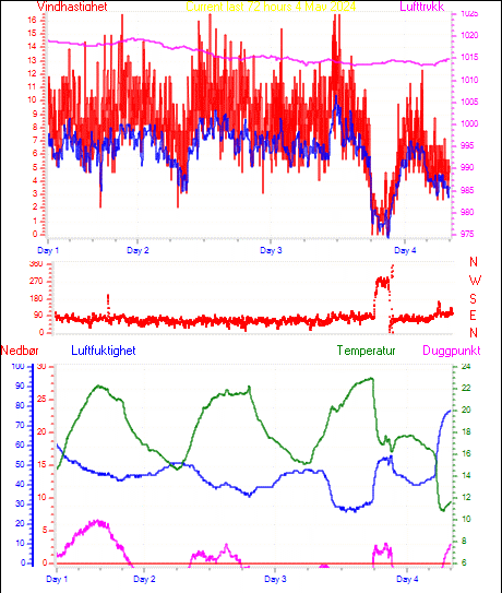
| LAST READING AT TIME: 09:46 DATE: 27 July 2024, time of next update: 09:47 | |||
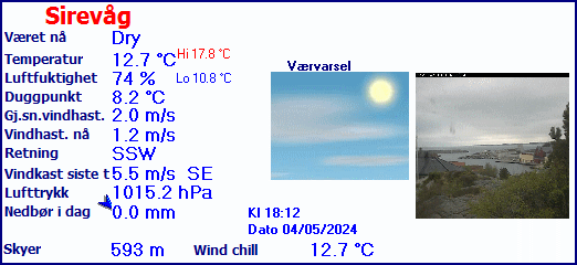
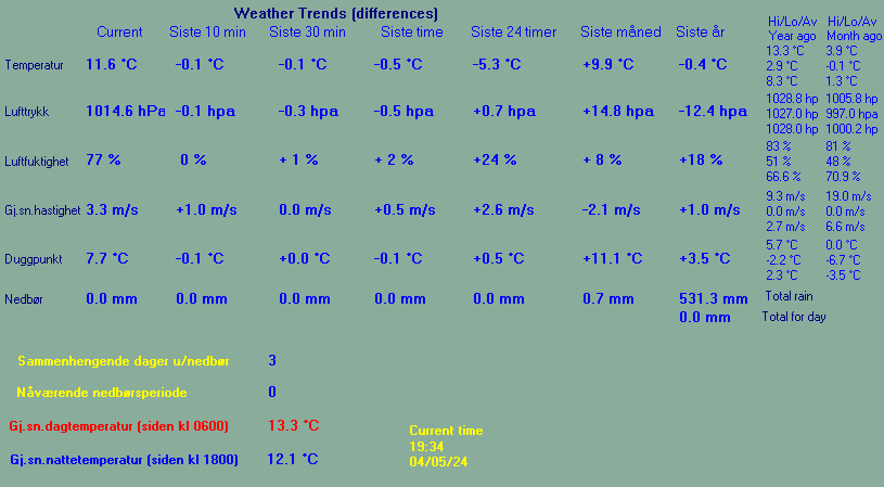
| Current Weather | Dry | Current Temperature | 15.9°C (60.6°F), Apparent temp 16.3°C |
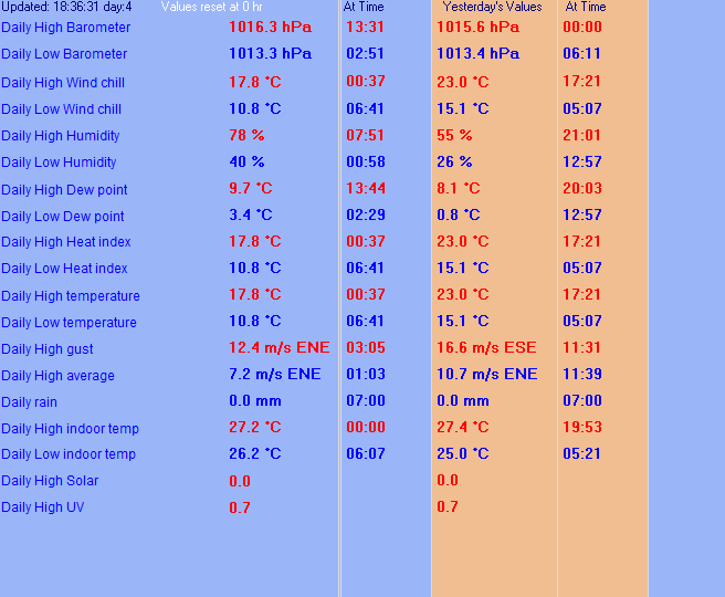
| Maximum Temperature (since midnight) | 15.9°C at: 09:41 | Minimum Temperature (since midnight) | 11.8°C at: 05:57 |
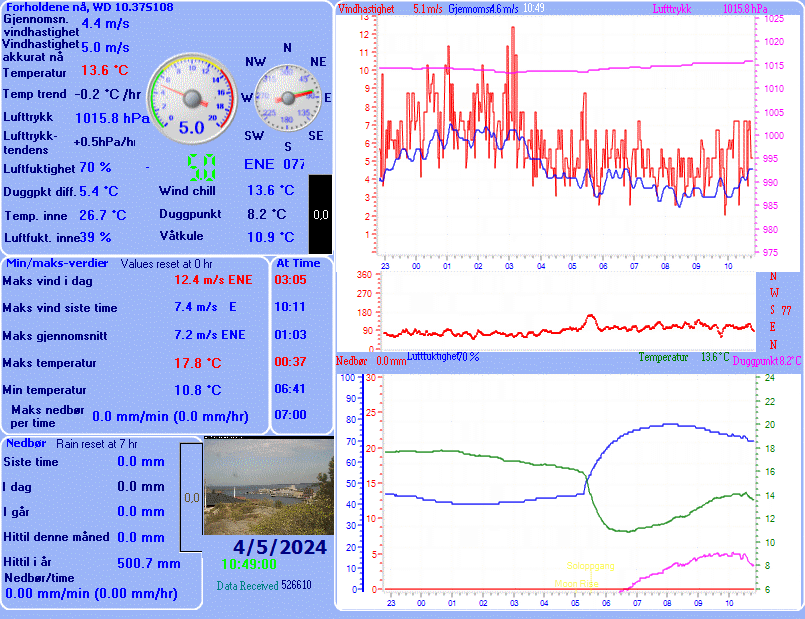
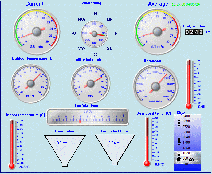
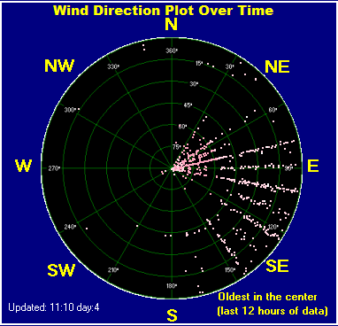
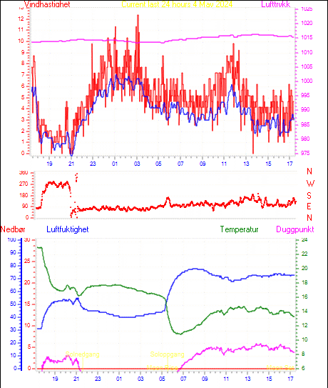
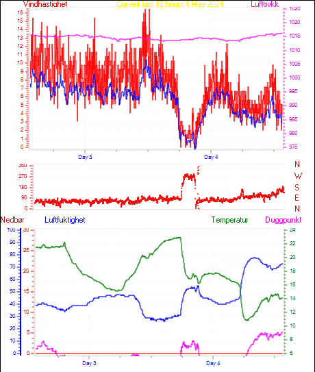
| Average windspeed (ten minute) | 0.2 m/s | Wind Direction (ten minute) | WSW (255°) |
| Windchill Temperature | 15.9°C | Maximum Gust (last hour) | 1.9 m/s at: 09:17 |
| Maximum Gust (since midnight) | 5.8 m/s at: 01:57 | Maximum 1 minute average (since midnight) | 5.0 m/s at: 02:01 |
| Rainfall (last hour) | 0.0 mm | Rainfall (since midnight) | 0.0 mm (0.00 in.)--- |
| Rainfall This month | 85.1 mm (3.35 in.) | Rainfall To date this year | 698.2 mm (27.49 in.) |
| Maximum rain per minute (last hour) | 0.0 mm/min | Maximum rain per hour (last 6 hours) | 0.0 mm/hour |
| Yesterdays rainfall | 0.7 mm | DewPoint | 12.3°C (Wet Bulb :13.9°C ) |
| Humidity | 79 %, Humidex 18.3°C | Barometer corrected to msl | 1012.4 hPa |
| Pressure change | +0.3 hPa (last hour) | Trend (last hour) | RISING |
| Pressure change (last 12 hours) | +2.7 hPa | Pressure change (last 6 hours) | +1.5 hPa |

Use the RELOAD facility on your browser to retrieve the latest data.